|
|
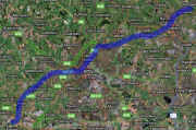
| The Derby Friar gate Line Route Map (aka GNR Derbyshire and Staffordshire Extension) | |
|
On my map I have traced the entire original route of the Friar
Gate Line from its junction at Egginton all the way to Nottingham.
Along the way I have marked on the locations of the all the GNR
railway stations that served the Friar Gate line. |
|
|
Large sections of the route have been or are
being, converted to cycle paths and walkways and adopted by
Sustrans. If you have some photographs of the Friar
Gate line then please add them to my dedicated Friar Gate Line Flickr group. |
|
|
The GNR Friar Gate Line Serving stations I hope you find my Friar Gate Line Route map of interest, perhaps you will learn something from it that you did not know before. |
|
|
Here are some of the reference books I used to plot the route of Friargate line:
|
|
|
|
|
© Andy Savage © www.derbyphotos.co.uk