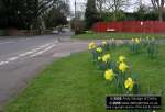
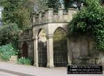
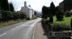
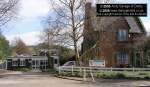
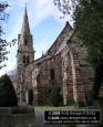
DP-180305QUARN-01
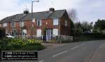
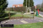
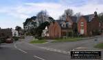
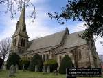
DP-180305QUARN-02
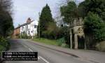
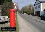
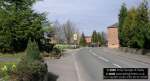
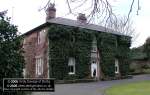
DP-180305QUARN-03
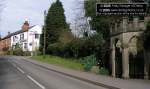
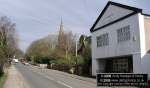
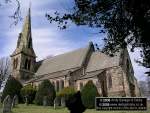
DP-180305QUARN-04
This page
features pictures and historical information about the following:
Quarndon. This is located in Derbyshire.
|
If you would like
to see photos of other Areas of Derby, Derbyshire and the Midlands then
click on the main index button at the bottom of this page. |
| Photos
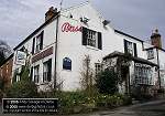
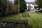
of Quarndon, Derbyshire, England. Quarndon is a charming village located not far from Derby, near Allestree.It has some great views of Kedleston Hall on one side and the Derwent Valley on the other. There was a settlement in Quarndon by the 9 th Century. Its name is said to be derived from two old English words : Cwoern meaning mill and dun meaning hill. Quarndon Church Hall Located down the road is a former Wesleyan Chapel and school room which was built in 1859. This is now a private house but about 1960 it was converted into Quarndon Village Stores and post office. The Pinfold (226 Burley Lane). The village Pound, Pinfold or Penfold was a small enclosure in which stray animals were impounded until collected by their owners on payment of a small fine. The fine was probably one penny and went to the Lord of the Manor. Saint Paul's Church Only the Ivy-covered west tower of the original 12 th Century chapel remain (at the end of Old Vicarage lane). The Nave and Chancel were demolished when the new church was erected at the top of the hill. Quarndon Millennium Sunclock The Joiners' Arms The Chalybeate Located just a few yards down the road from the Joiners Arms. The late Brian Clough spent his retirement in Quarndon. |
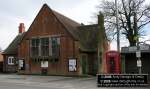
| DP-180305QUARN-01 - shows a view of Old church lane. DP-180305QUARN-02 - View on Church Road DP-180305QUARN-03 and 04 - View of the Chalybeate and The Joiners' Arms pub. DP-180305QUARN-05 - A close up view of The Chalybeate DP-180305QUARN-06 and 07 - The Joiners' Arms pub and beer garden above The Chalybeate. DP-180305QUARN-08 - Quarndon Church Hall. DP-180305QUARN-09 - View looking down Church road. DP-180305QUARN-10 - Quarndon Millennium Sunclock DP-180305QUARN-11 - View looking up Church road towards the Chapel and church. DP-180305QUARN-12 - View of the former Wesleyan Chapel. DP-180305QUARN-13 - The Curzon CE Primary School DP-180305QUARN-14 and 15 - Views on Burley Lane DP-180305QUARN-16 to 18 Saint Paul's Church DP-180305QUARN-19 - Former Quarndon Hall. DP-180305QUARN-20 - Coat of Arms on the side of the Church hall. |
DP-180305QUARN-01 |
DP-180305QUARN-02 |
DP-180305QUARN-03 |
DP-180305QUARN-04 |
 DP-180305QUARN-05 DP-180305QUARN-05 |
 DP-180305QUARN-06 DP-180305QUARN-06 |
 DP-180305QUARN-07 DP-180305QUARN-07 |
 DP-180305QUARN-08 |
 DP-180305QUARN-09 DP-180305QUARN-09 |
 DP-180305QUARN-10 DP-180305QUARN-10 |
 DP-180305QUARN-11 DP-180305QUARN-11 |
 DP-180305QUARN-12 |
 DP-180305QUARN-13 DP-180305QUARN-13 |
 DP-180305QUARN-14 DP-180305QUARN-14 |
 DP-180305QUARN-15 DP-180305QUARN-15 |
 DP-180305QUARN-16 |
 DP-180305QUARN-17 |
 DP-180305QUARN-18 DP-180305QUARN-18 |
 DP-180305QUARN-19 DP-180305QUARN-19 |
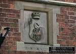 DP-180305QUARN-20 |
| Click
the button below to go to the main index of www.derbyphotos.co.uk |
| |
® www.derbyphotos.co.uk